Special Update SA Severe Thunderstorms 12th-13th Nov 2022
Special Update SA Severe Thunderstorms 12th-13th Nov 2022
G’Day everyone! As promised a bit of a spiel about tomorrow’s system and what we might expect through the course of the day – it is looking fairly significant although I think if you are far south enough, you should escape the worst of the thunderstorm activity and mostly be dealing with showers, rain and humid conditions.
Meteorological Discussion
Essentially what we are looking at is a deepening low out of WA, moving SE into SA tonight (Fri 11th). This low with combine with a very strong jetstream to it’s north and upper trough to it’s west to generate showers and thunderstorms overnight tonight out west, moving eastwards tomorrow with multiple severe thunderstorms likely.
Fri 11th
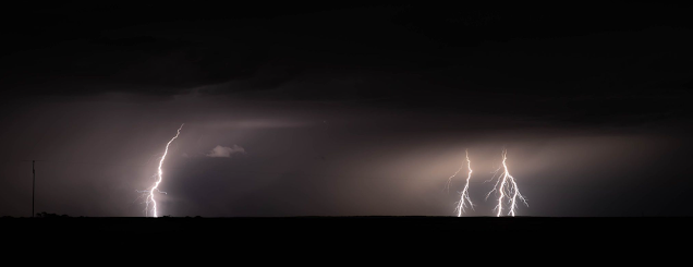
For the most part today will be a lovely day for a majority of the state apart from some isolated afternoon and evening showers and thunderstorms developing across the NW Pastoral well into the interior. Through the evening however after dark, the main event starts to show it’s muscle. A strong mid level jetstream around 500hPa (See Figure 1) will advance rapidly from the NW ahead of the upper trough further west. As this advances, it will induce the development of the low level jetstream (LLJ) (See Figure 2) from the north ahead of the low which should be located approximately in the Nullarbor vicinity by closer to midnight. This LLJ will trigger new elevated (high based) showers and thunderstorms over the NW Pastoral and West Coast areas, expanding well offshore into the Bight in some form of an arc as the convergence begins to increase caused by the pressure generated by the Low Level Jetstream. Gusty E to NE winds will pick up as a result fueling low level convergence.

Figure 1: 500hPa winds at 10:30pm SA time showing mid-level jetstream – source BSCH http://stormcast.com.au/stormcast.html?ops=gfs:2022111100:2022111112:sa:s500:null:0#sc

Sat 12th
During the pre-dawn hours, the low level jetstream will mature causing strong and gusty E to NE winds over much of the West Coast District. Some gusts may be close to severe at times near the coast about the Ceduna region. Showers and thunderstorms will most likely contract well offshore to the south in that developing arc. Across the Eyre Peninsula and Yorke Peninsula and perhaps the southern gulf areas there may be a mix of patchy light rain areas or isolated thundery showers triggered by the outer edge of this low level jetstream.
A few hours before sunrise it appears a nocturnal cluster of thunderstorms riding a gravity wave may develop over the Bight and track more eastwards across the coast and into Eyre Peninsula. This will likely become severe and start to pull left of the main steering with a dominant intense core towards
the northern edge. If this does form, then this thunderstorm may contain large hail of at least 3-4cm in size.
After sunrise, we should see a slight weakening of the low level jet but not by a lot. Renewed showers and thunderstorms will develop over the Eyre Peninsula and waters to the south and begin to spread eastwards, with the more northern activity having the most ‘free air’ and thus the greatest severe potential with large hail, damaging winds and intense rainfall/flash flooding. To the south and SE of these stronger left moving storms there will probably be some trailing rain areas and mess, especially towards the Adelaide area and beyond.

As we move through the afternoon, the thunderstorms will most likely be merged into one or two large clusters heading east with the northern edge have that left moving potential still. With heating and the approach of a strong jet stream in the upper levels and SE exit area (the most favourable region of strong ascent aloft), further thunderstorms should develop ahead of the trough off Eyre Peninsula, the Yorke Peninsula and the general Lower and Upper North fed by moist and humid E to NE winds ahead of the low. Some of these thunderstorms will be severe with large hail, damaging to destructive winds and intense rainfall leading to flash flooding. The greatest severe threat will be over the Eastern to NE Eyre Peninsula, Southern NW Pastoral into the Flinders and Upper North areas and potentially into the Lower North and this may extend eastwards into the Southern NE Pastoral and Riverland by the evening. There may be one or two more dominant left moving supercell thunderstorms that causes a path of damage with a risk of large to very large hail later in the day as instability increases from the west (see Figure 3) due to cooling mid levels and greater low level moisture. Wind shear will favour strong, organised thunderstorms with a couple being long-lived. There is an outside chance of a tornado in the strongest storm due to abundant low level helicity.
Further south towards Adelaide there is still a risk of severe thunderstorms, most likely coming across from the gulf but not as much as further north. Adelaide may see a messy day of decayed thunderstorms and patchy rain areas developing from near sunrise or possibly even before but it will likely be humid across most districts. As evening falls, most thunderstorms will be merging into either large clusters or a general MCS (Mesoscale Convective System) with a broad squall line like feature across the RIverland, Mallee and into NSW/VIC. Further isolated thunderstorms are still likely to develop through the evening as there will be strong instability and wind shear up until the surface trough crosses most districts. This trough is due into the Adelaide area by about 10:30pm
Further south across the SE Districts the threat decreases further, more so across the Lower SE however as the night progresses then these districts are more likely to see activity.
Sun 13th
There willl likely be ongoing shower and thunderstorm activity over the NE Pastoral with severe thunderstorms in the NE corner and perhaps towards the Eastern border however as the broad upper trough approaches, the mid to upper level flow will increase and thus further scattered showers and isolated thunderstorms will develop and stream SE through the night from roughly north of Port Augusta down to the Riverland.
Further west, colder air aloft in the middle of the upper trough will drive showers across from the Bight into most agricultural areas with the risk of an isolated thunderstorm over the Eyre Peninsula and Yorke Peninsula’s pushing east across the remaining Central regions during the afternoon. Whilst thunderstorms won’t have the power of the day before, there is a risk of borderline large hail or large accumulations of small hail as well as damaging winds. Showers will be squally at times as the surface low causes a blustery and cooler SW flow across the state but especially over the Lower SE District later in the day and at night.
Other possibilities
I thought I’d quickly touch on a few differing scenarios and how that may affect things during Saturday.
If the morning activity is too strong and widespread in cover, it will temper and overturn the troposphere resulting in limited severe potential during the afternoon and evening. This will reduce
the large hail threat a little but increase the chances of greater rainfall coverage but less intense rainfall.
Conversely if the morning activity is able to be cleared out fairly easily to the E/SE and the resultant convective development is not too rapid after, then by late afternoon the severe potential will increase resulting in more vigourous thunderstorms (but again in those areas mentioned chiefly north and NW of Adelaide.
In short the greater hail threat lies north and NW of Adelaide across E to NE Eyre Peninsula, Central to N Yorke Peninsula, Southern NW Pastoral, Flinders, Upper and Lower North, the Southern NE Pastoral and potentially into the RIverland. The Outer Northern Adelaide Plains begin to see that threat reduce slowly and then much more closer to the city and south and east of from there.
The greatest heavy rainfall threat lies more north and east of Adelaide including the Riverland, Mallee (Murraylands), Southern NE Pastoral, Lower and Upper North, Flinders and possibly the NE and E of Eyre Peninsula although the coverage may be more isolated intense areas rather than coverage like it will be east of the ranges as that is where everything spreads out more into broader rain and thunderstorm areas.
Rainfall
Rainfall is very tricky with this one due to the highly thundery nature. Some people may scrape away with less than 5mm and be quite lucky as I’m sure by now rain is unwelcome. For the most part you can expect 8-15mm however there will be scattered falls to 25-30mm from heavier rain areas chiefly north and east of about Adelaide and in thunderstorms further west. However some intense thunderstorms or repeated training of thunderstorms may result in local totals up to 80-100mm given the raw potential. This is most likely over the Lower and Upper North, the Southern NE Pastoral and the Riverland later. It would be a great thing though if this simply didn’t happen but the underlying potential for such falls and resultant damage is certainly real.
Link to temporary blog website: https://farmweathersa.blogspot.com/
Happy Farming and Cheers from The Weatherman
*Note – For interest only, all thoughts are of The Weatherman and may not be reproduced without my consent.


Comments
Post a Comment