Quick Update - SA Series of fronts Sept 14-18th 2022
Quick Update SA series of fronts Sept 14-18th 2022
G’Day one and all, thought I’d throw a quick little update out before the usual mid-monthly given we have a series of fronts on the way and the combination of all of these should deliver more good falls to many districts, a nice follow up after the last event. This was mentioned as a potential cut off low with rain then showers in the September outlook so good to see it roughly come out.
Meteorological Discussion:
Wed 14th
A trough of low pressure will move swiftly in from WA, squeezing the isobars tightly ahead of it causing windy conditions. Strong ascent aloft will promote a vigourous low level jetstream out of the NE/N from the early hours of the day ahead of the trough. This should be sufficient to trigger high based showers and thunderstorms on and ahead of the trough. These will likely be quite lightning active over the West Coast, Eyre Peninsula and Bight areas before dawn, rapidly advancing ESE to reach the gulf areas by about sunrise. Upon sunrise the frequency will diminish however more showers will continue to develop along with isolated thunderstorms, more along the rear edge of the first activity. This activity should reach Adelaide by about 8am or so before reach the Mallee areas by closer to 9:30-10am. Renewed showers and isolated thunderstorms will continue to develop as the band progresses eastwards and extend up across the agricultural areas all the way towards the Flinders.
A cold front will then move in from the west during the afternoon, not that strong but should reach the Adelaide region by approx 2pm and be accompanied by a developing band of showers, possibly tending to patchy rain as it moves east of the ranges and across the SE Districts. Slight chance of a thunderstorm with this band but less likely than the first. All should quieten down during the evening as this activity contracts eastwards out of the state. This day should see the best chance of activity penetrating east of the ranges given a lot of it will be mid-level and dynamically driven from the upper levels.
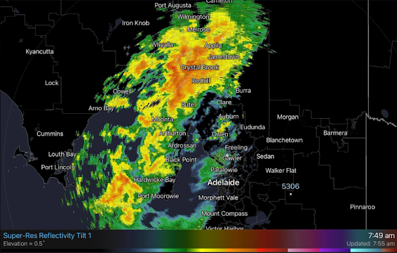
Thurs 15th
A complex upper low and surface low will develop south of the Bight and persist for a number of days. A number of shortwave troughs, some which will strengthen into cold fronts will subtend off that low, dumbelling around it till at least Saturday. One will cross during Thursday morning reaching Lower Eyre Pen by about 7:30am with a band of showers. NW winds will freshen once again ahead of the front. This front will weaken as it moves eastwards with a bulk of rainfall occurring over Lower Eyre Pen, Lower YP, KI and the Southern Fleurieu with more isolated activity elsewhere, especially east of the ranges. However, a trough will form into a cold front out of the cold pool behind the morning front, and punch in with more vigour during the evening driving showers and isolated cold air thunder over much of the agricultural areas. This front will be due into the Adelaide area by roughly 6pm although showers are likely to form and thicken up in advance of the front, especially over the Eyre Peninsula. Again, due to nocturnal shadowing the penetration east of the ranges will be a limiting factor though areas west of the Murray River should receive some falls. Good chance of local heavy falls into known wet spots of Mt.Lofty Ranges during the evening with stream rises as orographic impact will be maximised.
Fri 16th
Another trough will form out of a broader pool of cold air and concentrate showers into a developing band or cluster as it moves ENE. A renewed burst of showers will be the result and due to the timing, have more inland penetration with solar heating to assist development further north and east. Local heavy falls and stream rises likely over the Adelaide Hills. Activity will become a little more isolated during the evening.
Sat 17th
Finally, we see a cold front stand up more out of the SW with some colder air although the coldest air will likely be aimed into the SE districts and SW VIC. Small hail is likely there with this system as well as general squally SW winds as the isobars get squeezed nicely. Isolated cold air thunder cannot be ruled out either, chiefly in the afternoon in the same districts. Elsewhere, scattered showers, will drive NE across the agricultural areas but become isolated during the evening as a new high finally gets a chance to muscle in and move the associated low away.
Rainfall:
Totals to 9am Sun 18th:
Eyre Peninsula:
General 15-20mm with scattered totals to 25mm. Isolated 30mm possible about the exposed SW coast. Totals decrease about far NE EP down to around 5-8mm.
Upper North:
General 12-22mm with scattered falls to 30mm. Isolated falls to 40mm about higher peaks and known wet spots. Totals decreasing to the far N and E off the back of the ranges down to 8-15mm.
Lower North:
General 20-30mm falls, with scattered 35mm totals. Isolated heavier falls to 50mm about higher terrains and known wet spots. Totals decreasing off backs of ranges down to around 15-20mm.
Yorke Peninsula:
General 15-25mm falls, with scattered 30mm totals. Isolated heavier falls to 40mm possible about the foot. Totals decreasing towards eastern coast around 12mm or so potentially.
Kangaroo Island:
General 25-35mm falls, with scattered 40mm totals. Isolated heavier falls to 45mm possible about the western end. Totals decreasing over far east down to around 15-20mm or so.
Adelaide Plains:
General 25-35mm falls, with scattered 40mm totals. Isolated heavier falls to 50mm near foothills. Totals decreasing over western suburbs to 15-20mm or so.
Mt.Lofty Ranges:
General 35-55mm falls, with scattered 60-70mm totals. Isolated heavier falls to 80-90mm about known wet spots and higher peaks. Totals decreasing over far southern/SE ranges down to around 25-30mm or so. Expect local flooding of creeks and rivers and stream rises with possible roads under at times near crossings.
Riverland:
General 12-20mm with scattered falls to 20mm. Isolated falls to 25mm in the south. Totals decreasing towards the N Riverland around 8-12mm.
Mallee:
General 15-20mm with scattered falls to 25mm. Isolated falls to 30mm in the south. Totals decreasing towards the NE border near Riverland around 12-15mm.
Upper SE:
General 25-35mm with scattered falls to 40mm. Isolated falls to 45mm in the south. Totals decreasing towards the Mallee border around 20-25mm.
Lower SE:
General 35-45mm with scattered falls to 50mm. Isolated falls to 55mm about the coast. Totals decreasing in far N/NE to 30mm or so.
Western VIC:
General 25-35mm with scattered falls to 45mm. Isolated falls to 55-60mm about Grampians. Totals decreasing towards the Mallee border around 15-25mm and further down to 8-15mm towards the N Mallee.
Link to temporary blog website: https://farmweathersa.blogspot.com/
Happy Farming and Cheers from The Weatherman
*Note – For interest only, all thoughts are of The Weatherman and may not be reproduced without my consent.


Comments
Post a Comment